Alexandria Digital Research Library
About
FAQ
Usage Guidelines
Contact
Login
Search in
All Fields
Title
Subject
Accession Number
search for
Search
Alexandria Digital Research Library
Toggle facets
Limit your search
Format
Map
[remove]
5,346
Collection
7
Collection
Maps of Asia
4,903
Maps of Central and South America
388
Maps of California
35
Maps of North America
5
Maps of Santa Barbara County
5
Index Maps
2
Maps of Oceans
1
Contributor
Soviet Union. Sovetskai︠a︡ Armii︠a︡. Generalʹnyĭ shtab
4,903
Conselho Nacional de Geografia (Brazil)
389
PS Associates (Cardiff by the Sea, Calif.)
33
United States. Army Map Service
5
United States. Marine Corps
3
California. Division of Oil, Gas, and Geothermal Resources
1
Century Company
1
Santa Barbara (Calif.)
1
Student Council on Pollution and the Environment. Pacific Southwest Region.
1
University of California, Santa Barbara. Map and Imagery Laboratory
1
Topic
Continental shelf
33
Excavations (Archaeology)
33
Air bases
3
Airports
3
Discoveries in geography
1
Discovery and exploration
1
Gas fields
1
Geology
1
Geothermal resources
1
Land use
1
Offshore oil and gas leases
1
Oil fields
1
Water tunnels
1
Place
China
4,904
Brazil
389
California, Southern
33
Pacific Coast (Calif.)
33
Greenland
5
Santa Barbara (Calif.)
4
Arctic regions
1
California
1
Santa Barbara Channel (Calif.)
1
Santa Barbara County (Calif.)
1
Genre
topographic maps
5,296
military maps
4,906
coastal zone maps
33
engineering maps
3
index maps
2
thematic maps
2
geological maps
1
land use maps
1
regional maps
1
Date
Date range begin
–
Date range end
Current results range from
1902
to
2016
View distribution
Unknown
7
Library Location
Map and Imagery Laboratory
5,346
Rights
In Copyright
5,292
No Copyright - United States
46
Copyright Undetermined
1
Search Constraints
Start Over
You searched for:
Format
Map
Remove constraint Format: Map
« Previous
|
5,301
-
5,346
of
5,346
| Next »
Sort by creator descending
relevance
year ascending
year descending
creator ascending
creator descending
Number of results to display per page
50 per page
10
per page
20
per page
50
per page
100
per page
View results as:
List
Gallery
Slideshow
Search Results
List of items deposited in Alexandria Digital Research Library that match your search criteria
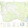
Laranjeira
Format:
Map
Collection:
Maps of Central and South America
Contributors:
Conselho Nacional de Geografia (Brazil)
Issued Date:
1987
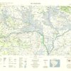
Belém
Format:
Map
Collection:
Maps of Central and South America
Contributors:
Conselho Nacional de Geografia (Brazil)
Issued Date:
1987
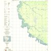
Xambioá
Format:
Map
Collection:
Maps of Central and South America
Contributors:
Conselho Nacional de Geografia (Brazil)
Issued Date:
1987
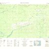
Tarauacá
Format:
Map
Collection:
Maps of Central and South America
Contributors:
Conselho Nacional de Geografia (Brazil)
Issued Date:
1987
Carolina
Format:
Map
Collection:
Maps of Central and South America
Contributors:
Conselho Nacional de Geografia (Brazil)
Issued Date:
1987
Foz do Jordão
Format:
Map
Collection:
Maps of Central and South America
Contributors:
Conselho Nacional de Geografia (Brazil)
Issued Date:
1987
Santana do Araguaia
Format:
Map
Collection:
Maps of Central and South America
Contributors:
Conselho Nacional de Geografia (Brazil)
Issued Date:
1987
Serra Ricardo Franco
Format:
Map
Collection:
Maps of Central and South America
Contributors:
Conselho Nacional de Geografia (Brazil)
Issued Date:
1987
Volta Redonda
Format:
Map
Collection:
Maps of Central and South America
Contributors:
Conselho Nacional de Geografia (Brazil)
Issued Date:
1988
Santos
Format:
Map
Collection:
Maps of Central and South America
Contributors:
Conselho Nacional de Geografia (Brazil)
Issued Date:
1988
Ponta Porã
Format:
Map
Collection:
Maps of Central and South America
Contributors:
Conselho Nacional de Geografia (Brazil)
Issued Date:
1988
Almenara
Format:
Map
Collection:
Maps of Central and South America
Contributors:
Conselho Nacional de Geografia (Brazil)
Issued Date:
1988
Naviraí
Format:
Map
Collection:
Maps of Central and South America
Contributors:
Conselho Nacional de Geografia (Brazil)
Issued Date:
1988
Rio Uraricoera
Format:
Map
Collection:
Maps of Central and South America
Contributors:
Conselho Nacional de Geografia (Brazil)
Issued Date:
1988
Rio Mamoré
Format:
Map
Collection:
Maps of Central and South America
Contributors:
Conselho Nacional de Geografia (Brazil)
Issued Date:
1988
Serra dos Uopianes
Format:
Map
Collection:
Maps of Central and South America
Contributors:
Conselho Nacional de Geografia (Brazil)
Issued Date:
1988
Costa Marques
Format:
Map
Collection:
Maps of Central and South America
Contributors:
Conselho Nacional de Geografia (Brazil)
Issued Date:
1988
Pedras Negras
Format:
Map
Collection:
Maps of Central and South America
Contributors:
Conselho Nacional de Geografia (Brazil)
Issued Date:
1988
Vilhena
Format:
Map
Collection:
Maps of Central and South America
Contributors:
Conselho Nacional de Geografia (Brazil)
Issued Date:
1988
Baía Grande
Format:
Map
Collection:
Maps of Central and South America
Contributors:
Conselho Nacional de Geografia (Brazil)
Issued Date:
1988
Codajás
Format:
Map
Collection:
Maps of Central and South America
Contributors:
Conselho Nacional de Geografia (Brazil)
Issued Date:
1989
Lago Aiapuá
Format:
Map
Collection:
Maps of Central and South America
Contributors:
Conselho Nacional de Geografia (Brazil)
Issued Date:
1989
Coari
Format:
Map
Collection:
Maps of Central and South America
Contributors:
Conselho Nacional de Geografia (Brazil)
Issued Date:
1989
Cacoal
Format:
Map
Collection:
Maps of Central and South America
Contributors:
Conselho Nacional de Geografia (Brazil)
Issued Date:
1989
Presidente Médici
Format:
Map
Collection:
Maps of Central and South America
Contributors:
Conselho Nacional de Geografia (Brazil)
Issued Date:
1990
Colorado do Oeste
Format:
Map
Collection:
Maps of Central and South America
Contributors:
Conselho Nacional de Geografia (Brazil)
Issued Date:
1990
São Paulo
Format:
Map
Collection:
Maps of Central and South America
Contributors:
Conselho Nacional de Geografia (Brazil)
Issued Date:
1991
Aldeia Bacajá
Format:
Map
Collection:
Maps of Central and South America
Contributors:
Conselho Nacional de Geografia (Brazil)
Issued Date:
1991
Serra do Bacajá
Format:
Map
Collection:
Maps of Central and South America
Contributors:
Conselho Nacional de Geografia (Brazil)
Issued Date:
1991
Pato Branco
Format:
Map
Collection:
Maps of Central and South America
Contributors:
Conselho Nacional de Geografia (Brazil)
Issued Date:
1992
Guaíra
Format:
Map
Collection:
Maps of Central and South America
Contributors:
Conselho Nacional de Geografia (Brazil)
Issued Date:
1994
Guaraniaçu
Format:
Map
Collection:
Maps of Central and South America
Contributors:
Conselho Nacional de Geografia (Brazil)
Issued Date:
1995
União da Vitória
Format:
Map
Collection:
Maps of Central and South America
Contributors:
Conselho Nacional de Geografia (Brazil)
Issued Date:
1995
Foz do Iguaçu
Format:
Map
Collection:
Maps of Central and South America
Contributors:
Conselho Nacional de Geografia (Brazil)
Issued Date:
1997
Campo Grande
Format:
Map
Collection:
Maps of Central and South America
Contributors:
Conselho Nacional de Geografia (Brazil)
Issued Date:
1997
Entre-Rios
Format:
Map
Collection:
Maps of Central and South America
Contributors:
Conselho Nacional de Geografia (Brazil)
Issued Date:
1999
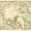
Region around the North Pole : giving the records of the most important explorations
Format:
Map
Collection:
Maps of Oceans
Contributors:
Century Company
Issued Date:
1902
Oil, gas and geothermal fields in California, 2001
Format:
Map
Collection:
Maps of California
Contributors:
California. Division of Oil, Gas, and Geothermal Resources
Issued Date:
2001
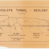
Tecolote Tunnel - geology
Format:
Map
Collection:
Maps of Santa Barbara County
Issued Date:
1954?
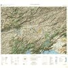
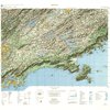
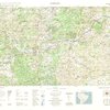
Maps of Central and South America
Format:
Collection and Map
Description:
Maps of Central and South America, as well as countries, regions and cities within Central and South America.
Index Maps
Format:
Map and Collection
Description:
Index maps for map sets in the UCSB Library collection.
Maps of Asia
Format:
Map and Collection
Description:
Maps of the continent of Asia, as well as countries, regions and cities within Asia.
Maps of California
Format:
Map and Collection
Description:
Maps of the state of California, as well as counties, regions and cities within California but outside of Santa Barbara County.
Maps of Oceans
Format:
Collection and Map
Description:
Maps of the world's oceans. For Pacific Ocean islands, see Maps of Oceania.
Maps of North America
Format:
Collection and Map
Description:
Maps of the continent of North America, as well as countries, regions and cities within North America but outside of the United States.
Maps of Santa Barbara County
Format:
Collection and Map
Description:
Maps of Santa Barbara County, as well as regions and cities within Santa Barbara County.
« Previous
Next »
1
2
…
103
104
105
106
107