Alexandria Digital Research Library
About
FAQ
Usage Guidelines
Contact
Login
Search in
All Fields
Title
Subject
Accession Number
search for
Search
Alexandria Digital Research Library
Toggle facets
Limit your search
Format
Map
[remove]
35
Collection
Maps of California
[remove]
35
Contributor
PS Associates (Cardiff by the Sea, Calif.)
33
California. Division of Oil, Gas, and Geothermal Resources
1
Student Council on Pollution and the Environment. Pacific Southwest Region.
1
Topic
Continental shelf
33
Excavations (Archaeology)
33
Gas fields
1
Geothermal resources
1
Offshore oil and gas leases
1
Oil fields
1
Place
California, Southern
33
Pacific Coast (Calif.)
33
California
1
Santa Barbara Channel (Calif.)
1
Genre
coastal zone maps
33
thematic maps
2
Date
Date range begin
–
Date range end
Current results range from
1970
to
2001
View distribution
Library Location
Map and Imagery Laboratory
35
Rights
No Copyright - United States
35
Search Constraints
Start Over
You searched for:
Collection
Maps of California
Remove constraint Collection: Maps of California
Format
Map
Remove constraint Format: Map
1
-
35
of
35
Sort by year descending
relevance
year ascending
year descending
creator ascending
creator descending
Number of results to display per page
50 per page
10
per page
20
per page
50
per page
100
per page
View results as:
List
Gallery
Slideshow
Search Results
List of items deposited in Alexandria Digital Research Library that match your search criteria
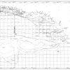
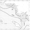
Oil, gas and geothermal fields in California, 2001
Format:
Map
Collection:
Maps of California
Contributors:
California. Division of Oil, Gas, and Geothermal Resources
Issued Date:
2001
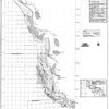
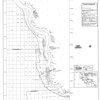
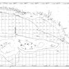
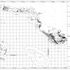
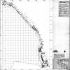
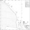
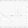
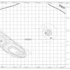
Isopach map of post-Wisconsin sediment thickness : Point Estero to Point Conception
Format:
Map
Collection:
Maps of California
Contributors:
PS Associates (Cardiff by the Sea, Calif.)
Issued Date:
1987
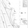
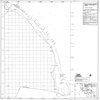
Isopach map of post-Wisconsin sediment thickness data sources : Point Estero to Point Conception
Format:
Map
Collection:
Maps of California
Contributors:
PS Associates (Cardiff by the Sea, Calif.)
Issued Date:
1987
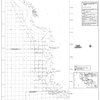
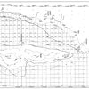
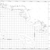
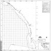
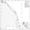
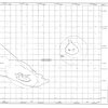
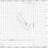
Prehistoric archaeological site distribution map : Point Estero to Point Conception
Format:
Map
Collection:
Maps of California
Contributors:
PS Associates (Cardiff by the Sea, Calif.)
Issued Date:
1987
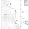
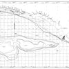
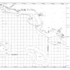
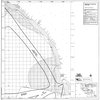
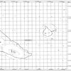
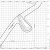
Shipwreck distribution map : Point Estero to Point Conception
Format:
Map
Collection:
Maps of California
Contributors:
PS Associates (Cardiff by the Sea, Calif.)
Issued Date:
1987
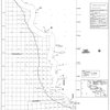
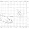
Prehistoric archaeological site predictive model map : Point Estero to Point Conception
Format:
Map
Collection:
Maps of California
Contributors:
PS Associates (Cardiff by the Sea, Calif.)
Issued Date:
1987
Shipwreck site predictive model map : Point Estero to Point Conception
Format:
Map
Collection:
Maps of California
Contributors:
PS Associates (Cardiff by the Sea, Calif.)
Issued Date:
1987
Isopach map of post-Wisconsin sediment thickness : Point Conception to Point Mugu & Channel Islands
Format:
Map
Collection:
Maps of California
Contributors:
PS Associates (Cardiff by the Sea, Calif.)
Issued Date:
1987
Isopach map of post-Wisconsin sediment thickness data sources : Point Conception to Point Mugu & Channel Islands
Format:
Map
Collection:
Maps of California
Contributors:
PS Associates (Cardiff by the Sea, Calif.)
Issued Date:
1987
Prehistoric archaeological site distribution map : Point Conception to Point Mugu & Channel Islands
Format:
Map
Collection:
Maps of California
Contributors:
PS Associates (Cardiff by the Sea, Calif.)
Issued Date:
1987
Shipwreck distribution map : Point Conception to Point Mugu & Channel Islands
Format:
Map
Collection:
Maps of California
Contributors:
PS Associates (Cardiff by the Sea, Calif.)
Issued Date:
1987
Prehistoric archaeological site predictive model map : Point Conception to Point Mugu & Channel Islands
Format:
Map
Collection:
Maps of California
Contributors:
PS Associates (Cardiff by the Sea, Calif.)
Issued Date:
1987
Shipwreck site predictive model map : Point Conception to Point Mugu & Channel Islands
Format:
Map
Collection:
Maps of California
Contributors:
PS Associates (Cardiff by the Sea, Calif.)
Issued Date:
1987
Isopach map of post-Wisconsin sediment thickness : Point Mugu to Newport Beach
Format:
Map
Collection:
Maps of California
Contributors:
PS Associates (Cardiff by the Sea, Calif.)
Issued Date:
1987
Isopach map of post-Wisconsin sediment thickness data sources : Point Mugu to Newport Beach
Format:
Map
Collection:
Maps of California
Contributors:
PS Associates (Cardiff by the Sea, Calif.)
Issued Date:
1987
Prehistoric archaeological site distribution map : Point Mugu to Newport Beach
Format:
Map
Collection:
Maps of California
Contributors:
PS Associates (Cardiff by the Sea, Calif.)
Issued Date:
1987
Shipwreck distribution map : Point Mugu to Newport Beach
Format:
Map
Collection:
Maps of California
Contributors:
PS Associates (Cardiff by the Sea, Calif.)
Issued Date:
1987
Prehistoric archaeological site predictive model map : Point Mugu to Newport Beach
Format:
Map
Collection:
Maps of California
Contributors:
PS Associates (Cardiff by the Sea, Calif.)
Issued Date:
1987
Shipwreck site predictive model map : Point Mugu to Newport Beach
Format:
Map
Collection:
Maps of California
Contributors:
PS Associates (Cardiff by the Sea, Calif.)
Issued Date:
1987
Isopach map of post-Wisconsin sediment thickness : Newport Beach to Mexican Border
Format:
Map
Collection:
Maps of California
Contributors:
PS Associates (Cardiff by the Sea, Calif.)
Issued Date:
1987
Isopach map of post-Wisconsin sediment thickness data sources : Newport Beach to Mexican Border
Format:
Map
Collection:
Maps of California
Contributors:
PS Associates (Cardiff by the Sea, Calif.)
Issued Date:
1987
Prehistoric archaeological site distribution map : Newport Beach to Mexican Border
Format:
Map
Collection:
Maps of California
Contributors:
PS Associates (Cardiff by the Sea, Calif.)
Issued Date:
1987
Shipwreck distribution map : Newport Beach to Mexican Border
Format:
Map
Collection:
Maps of California
Contributors:
PS Associates (Cardiff by the Sea, Calif.)
Issued Date:
1987
Prehistoric archaeological site predictive model map : Newport Beach to Mexican Border
Format:
Map
Collection:
Maps of California
Contributors:
PS Associates (Cardiff by the Sea, Calif.)
Issued Date:
1987
Shipwreck site predictive model map : Newport Beach to Mexican Border
Format:
Map
Collection:
Maps of California
Contributors:
PS Associates (Cardiff by the Sea, Calif.)
Issued Date:
1987
Isopach map of post-Wisconsin sediment thickness : Santa Barbara and San Nicholas Islands
Format:
Map
Collection:
Maps of California
Contributors:
PS Associates (Cardiff by the Sea, Calif.)
Issued Date:
1987
Isopach map of post-Wisconsin sediment thickness data sources : Santa Barbara and San Nicholas Islands
Format:
Map
Collection:
Maps of California
Contributors:
PS Associates (Cardiff by the Sea, Calif.)
Issued Date:
1987
Prehistoric archaeological site distribution map : Santa Barbara and San Nicholas Islands
Format:
Map
Collection:
Maps of California
Contributors:
PS Associates (Cardiff by the Sea, Calif.)
Issued Date:
1987
Shipwreck distribution map : Santa Barbara and San Nicholas Islands
Format:
Map
Collection:
Maps of California
Contributors:
PS Associates (Cardiff by the Sea, Calif.)
Issued Date:
1987
Prehistoric archaeological site predictive model map : Santa Barbara and San Nicholas Islands
Format:
Map
Collection:
Maps of California
Contributors:
PS Associates (Cardiff by the Sea, Calif.)
Issued Date:
1987
Shipwreck site predictive model map : Santa Barbara and San Nicholas Islands
Format:
Map
Collection:
Maps of California
Contributors:
PS Associates (Cardiff by the Sea, Calif.)
Issued Date:
1987
Shipwreck distribution map : San Clemente Islands, Tanner & Cortes Banks
Format:
Map
Collection:
Maps of California
Contributors:
PS Associates (Cardiff by the Sea, Calif.)
Issued Date:
1987
Shipwreck site predictive model map : San Clemente Islands, Tanner & Cortes Banks
Format:
Map
Collection:
Maps of California
Contributors:
PS Associates (Cardiff by the Sea, Calif.)
Issued Date:
1987
Archaeological resource study : Morro Bay to Mexican Border : final report
Format:
Map
Collection:
Maps of California
Contributors:
PS Associates (Cardiff by the Sea, Calif.)
Issued Date:
1987
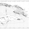
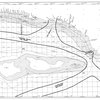
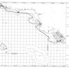
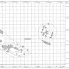
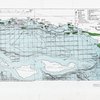
[Map of the Santa Barbara Channel, including all current oil leases and other pertinent data]
Format:
Map
Collection:
Maps of California
Contributors:
Student Council on Pollution and the Environment. Pacific Southwest Region.
Issued Date:
1970