Search Constraints
« Previous |
1 - 10 of 33
|
Next »
Number of results to display per page
Search Results
Select an image to start the slideshow
![Default](/image-service/qb98mf695%2Ffiles%2F416df21d-3108-49d8-bc06-ba0525e47a94/full/400,/0/default.jpg)
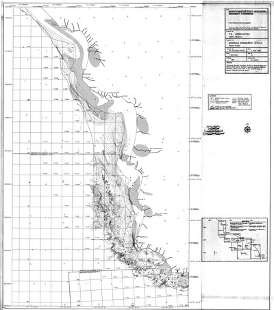
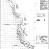
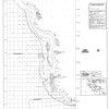
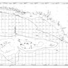
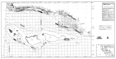
Isopach map of post-Wisconsin sediment thickness : Point Estero to Point Conception
1 of 10
![Default](/image-service/cv43nx17z%2Ffiles%2F80b1419c-68eb-4af1-bef8-656e0bcffd74/full/400,/0/default.jpg)
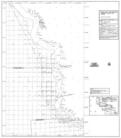
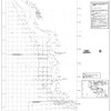
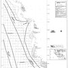
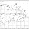
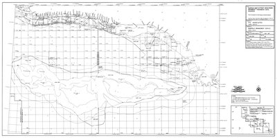
Isopach map of post-Wisconsin sediment thickness data sources : Point Estero to Point Conception
2 of 10
![Default](/image-service/tm70mv46p%2Ffiles%2F97ac1f85-bd97-438f-ab57-4c49bffa8d52/full/400,/0/default.jpg)
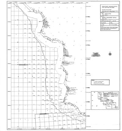
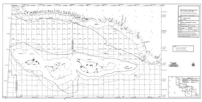
Prehistoric archaeological site distribution map : Point Estero to Point Conception
3 of 10
![Default](/image-service/dz010q323%2Ffiles%2Ff7c0c699-fd3a-46eb-afd4-3d9f2a23ff28/full/400,/0/default.jpg)
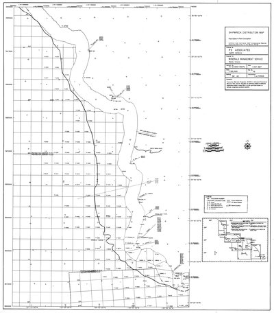
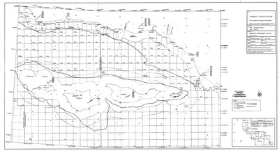
Shipwreck distribution map : Point Estero to Point Conception
4 of 10
![Default](/image-service/f1881m124%2Ffiles%2Fc114f56e-893c-45ae-b5c6-401bc4c34250/full/400,/0/default.jpg)
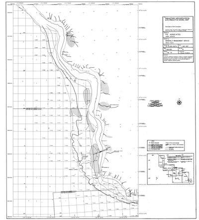
Prehistoric archaeological site predictive model map : Point Estero to Point Conception
5 of 10
![Default](/image-service/br86b3812%2Ffiles%2Fe4832852-8e62-4635-93c6-96f9d98bd0b1/full/400,/0/default.jpg)
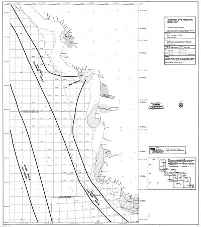
Shipwreck site predictive model map : Point Estero to Point Conception
6 of 10
![Default](/image-service/sq87bt81x%2Ffiles%2F2073e5bd-4dae-4b6c-b6b1-62df1a816a61/full/400,/0/default.jpg)
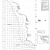
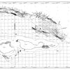
Isopach map of post-Wisconsin sediment thickness : Point Conception to Point Mugu & Channel Islands
7 of 10
![Default](/image-service/jm214p40x%2Ffiles%2F42712dc0-14c7-4509-a2e4-8b62c616c0ea/full/400,/0/default.jpg)
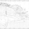
Isopach map of post-Wisconsin sediment thickness data sources : Point Conception to Point Mugu & Channel Islands
8 of 10
![Default](/image-service/47429934j%2Ffiles%2Fb29b7252-addd-41fe-9990-21fe8f31c0be/full/400,/0/default.jpg)
Prehistoric archaeological site distribution map : Point Conception to Point Mugu & Channel Islands
9 of 10
![Default](/image-service/vm40xr869%2Ffiles%2Fe1b51a2a-9d1a-42ae-a05a-aa4096104f5b/full/400,/0/default.jpg)
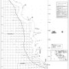
Shipwreck distribution map : Point Conception to Point Mugu & Channel Islands
10 of 10
- « Previous
- Next »
- 1
- 2
- 3
- 4